Hello readers! This week is the final instalment in a three-part series on a Victorian science book: Principles of Geology, by Charles Lyell. In the last two posts we explored the chapters on climate and evolution, and discussed how our understanding has changed over the last 200 years thanks to technological advancements and conceptual breakthroughs. This week, we’re looking at volcanoes, earthquakes and igneous rocks (an old favourite on this blog). But before we begin, ask yourself this: how far do you think our understanding of volcanoes has advanced since 1830? How much have our models and predictions improved, when it comes to earthquakes and eruptions?
It’s worth reiterating that the aim of these posts is not to look back and laugh at the ignorance of our predecessors. Instead, we’re aiming to identify the barriers they faced in their research, such as missing data, flawed theories, or a lack of computing power. These barriers are obvious to modern readers, but some of them were entirely invisible to scientists in 1830 (such as the fact that the Earth’s crust is divided into giant, shifting plates). These invisible walls hindered scientific advancement – and a different set of invisible walls must be hindering scientists today. After all, we can’t overcome an obstacle if we don’t realise that it exists.
The best way to find these invisible walls is to collect more data, and to devise new ways of interpreting old data – both of which are aided by advances in technology. The data act like pieces of a puzzle, and as more pieces become available, there is a better chance of someone noticing a pattern and assembling the picture. Technological advancements in the geological sciences have led to more data being collected than ever before, and this has allowed us to refine our theories of Earth system processes, and to identify the gaps in our understanding. But how far have we come since 1830? How many gaps remain?

The rock cycle, according to Lyell
The rock cycle in Principles of Geology is almost identical to the one taught in schools today. Many sedimentary rocks are deposited beneath the sea, only to be uplifted into land and mountains millions of years later, where they are eroded by ice, wind and rain. The eroded fragments are returned to the sea by glaciers and rivers, and there they are laid down as new rocks. These rocks may be altered by volcanic heat, or contorted by high pressures at depth, before they are uplifted returned to land once more.
However, this rock cycle was not a new idea. It had been outlined by James Hutton 50 years before Charles Lyell published Principles, and the geological community had already largely accepted it. Lyell had a lot of respect for Hutton, and in Principles he echoed many of Hutton’s revolutionary insights (often misquoting them, although he conveyed the general gist). Unlike Hutton, however, Lyell had a massive mainstream audience. Principles was read widely – not just by geologists – and this was the first time that ordinary people (or, at least, middle-class, literate Victorians) had been exposed to the concept of the rock cycle.
Still, Lyell didn’t agree with all of Hutton’s assertions, and he made some modifications to the original idea. He knew that many of the rocks beneath our feet had been “raised from the deep”, but the mechanism for raising them remained unclear. Hutton had thought that rocks were uplifted en masse during violent, catastrophic periods, before eroding and subsiding in slow, quiet periods. Lyell didn’t much like this idea – which isn’t so surprising given his insistence that conditions on Earth had been relatively constant throughout geological history (the principle of uniformitarianism). Instead, Lyell viewed uplift as a constant, gradual process. It was well known that rocks could be shifted up and down during earthquakes, and Lyell proposed that because earthquakes were always happening somewhere, rocks were always moving.
Principles contains multiple chapters detailing various stages of the rock cycle. Some sections read like a modern GCSE geography textbook: Lyell even included a diagram showing the evolution of meanders and oxbow lakes (which makes this meme much older than any of us realised). He also wrote a whole paragraph detailing the velocities of water, in inches per second, required to carry various sizes of grit, although I’m not sure how (or if) he actually measured these. In Volume III (I’m only reading an abridged version, but the book was originally published in three volumes), Lyell presented the rules for gauging the relative ages of rocks, which any modern geology student will find very familiar (younger rocks on top of older rocks, etc.). So, from a sedimentary standpoint, it seems that little has changed since 1830.
The rock cycle, from a modern perspective
While our interpretations of sedimentary rocks have remained mostly unchanged, there have been seismic shifts in our understanding of larger-scale processes (pun most definitely intended). Lyell and Hutton occupied opposite ends of the spectrum when it came to estimating rates of uplift – and our modern view is somewhere between these extremes. Uplift happens slowly on human timescales, but its rate can vary, and depends on its regional setting. Our understanding has been aided enormously by satellite monitoring. For example, we can now measure elevation changes with great precision (for land above the sea, at least), and satellite imagery allows us to view landscapes on such vast scales that the buckling of colliding continents is immediately apparent. The Victorians had no way to see the large-scale distortion of land around the Alps or Himalayas, but these days, almost anyone can access Google maps and explore these planetary features for themselves. The patterns of wrinkles in the Earth’s crust, hundreds of kilometres in scale, are proof that the continents are moving – but you would struggle to comprehend this without an aerial view, no matter how far you travelled.
Igneous rocks, according to Lyell
18th and 19th century geologists were quite happy identifying and interpreting sedimentary rocks, but when it came to anything remotely crystalline, there was a bit more confusion. The influential German geologist Abraham Werner believed that most igneous rocks had precipitated from water, and this idea was widely accepted around Europe – despite the fact that French geologists had shown, quite unambiguously, that igneous rocks such as basalts could be traced back to volcanoes. Lyell strongly opposed Werner’s watery ideas. He had travelled much more than Werner, and had seen a huge variety of ancient igneous rocks in Scotland, as well as fresh volcanic rocks in Italy. As such, he became a leading advocate for igneous rocks crystallising from magma, and it wasn’t long before Werner’s ideas were discarded.
However, while Lyell might have been confident in his molten formation mechanism, he was not certain where magma came from. He was very dismissive of the notion that the Earth had been entirely molten after its formation – an idea which was gaining traction around Europe, based on the ideas of Joseph Fourier. Lyell insisted that there was no evidence of molten origins, and in his view, there was no point in coming up with hypotheses if there was no way to prove them. Supporters of the molten theory believed that the Earth’s surface was only a thin crust over incandescent lava, but Lyell refused to engage with these ideas, deeming them to be idle speculation.
In the end, Lyell didn’t attempt to explain the origin of magma. He noted that the source of volcanic heat varies in position and with time, with many regions having hosted volcanic activity at different points in their history, so he assumed that volcanic activity could rise up at random, akin to a storm or flood. However, he was confident in interpreting ancient volcanic conduits. For example, dykes are cracks that transmit magma to the surface, and when they cool and solidify, they produce planes of solid, igneous rock, which are later exposed when the rocks around them are eroded. Lyell recognised dykes for what they were, but he appreciated that they were relatively shallow features, and he acknowledged that deeper conduits would remain inaccessible and unknown.
Igneous rocks, from a modern perspective
Technological advancements have allowed us to learn much more about igneous rocks. For example, we can melt rock samples in the lab, then watch them crystallise under different pressure and temperature conditions. We can calculate the absolute ages of rocks based on the trace amounts of radioactive elements inside them. On a larger scale, seismometers and computers allow us to pinpoint the origins of earthquakes, which we can read as indicators of magma movement below ground, allowing us to trace the paths and ascent rates of dykes. We have also developed computer simulations of fluids fracturing through solid rocks, allowing us to reconstruct or forecast magma movements. So, although the depths remain inaccessible, as Lyell predicted, we have found other ways to interpret what lies beneath our feet.
Of course, there are still plenty of gaps in our understanding. For example, we know that magma is generated where tectonic plates are being pulled apart, creating low pressure (e.g., Mid-Atlantic Rift), or where one plate is being subducted under another, introducing water into the mantle (e.g., Japan), but there are also places where volcanism occurs in the middle of tectonic plates, such as Hawaii, which are attributed to “hot spots” in the Earth’s mantle. The origin of hot spots is still unclear, but their material is believed to have risen all the way up from the core-mantle boundary. Only in the last 15 years have geologists managed to use earthquakes to interpret the dimensions of these features – but the trigger for their formation remains a matter of debate.
Earthquakes, according to Lyell
In the original edition of Principles, several chapters were devoted to describing various earthquakes around Europe, detailing the amount of shaking, the buildings damaged, and the cracks that formed in the ground. However, Lyell never proposed a reason for earthquakes. He suggested that earthquakes and volcanoes are closely related, and went so far as to assert that they are “probably the effects of the same subterranean process”, given that they so often occur in the same places. However, there is a strong sense of awe and fear in these chapters, with the implication that these are processes beyond human understanding. Lyell concluded that we may never know the causes of earthquakes, because it would be impossible to create experiments that reproduce conditions at such depths.
Earthquakes, from a modern perspective
As I mentioned in the first post in this series, many of Lyell’s conundrums can be readily explained with a little help from plate tectonics – the theory that now forms the backbone of the geological sciences. Lyell was right that earthquakes tend to occur in specific places, and that these regions are often volcanic. Over a century after Principles was published, scientists realised that earthquakes occur at the edges of tectonic plates – that the Earth’s crust is split into giant slabs that are constantly moving, grating against one another. Earthquakes occur when the slip-planes between chunks of land get stuck. Pressure builds up, and when the slip-plane ruptures, it releases the pent-up energy suddenly and violently. These slip-planes are called faults, and they vary in length, depth, slip direction, and propensity for getting stuck, which leads to a range of earthquake behaviours.
However, when Lyell wrote about earthquakes, he depicted them as a mechanism in their own right, rather than a symptom of a larger process. He describes them as the drivers of uplift, rather than as a side-effect of land being shunted upwards. With a better knowledge of material physics and elasticity, he might have interpreted quakes as sudden releases of pent-up energy – but even then, he would have struggled to find an explanation for where this energy came from, or why the Earth’s surface should be constantly moving. There have been some enormous leaps in our understanding of Earth processes in this regard. Plate tectonics changed everything.
Volcanoes, according to Lyell
Charles Lyell visited a lot of volcanoes, and dedicated many chapters to describing them (most of which have been cut out of the abridged edition). Safe to say, he had some interesting ideas about why volcanoes erupt.
Firstly, Lyell mentions someone called Henderson travelling to Iceland and throwing a load of stones in the famous Geysir (the one after which all geysers are named), just to see what happened. Apparently, there was a pause in activity, before it emitted an enormous jet, far taller and more violent than usual. This simple test allowed scientists to formulate a model: they realised that steam was building up at depth, reaching a critical pressure, then blasting water to the surface. By blocking the conduit with rocks, pressures rose higher than usual, and the subsequent eruption was bigger. Just goes to show what we can learn by acting on childish instinct…

Lyell wondered if volcanoes erupted following similar rules to the Geysir. Something had to be pushing molten rock to the surface, and he proposed that water turning into steam might provide the necessary propulsion. However, he didn’t question where the water came from, or the depths at which this might happen.
An Etna obsession
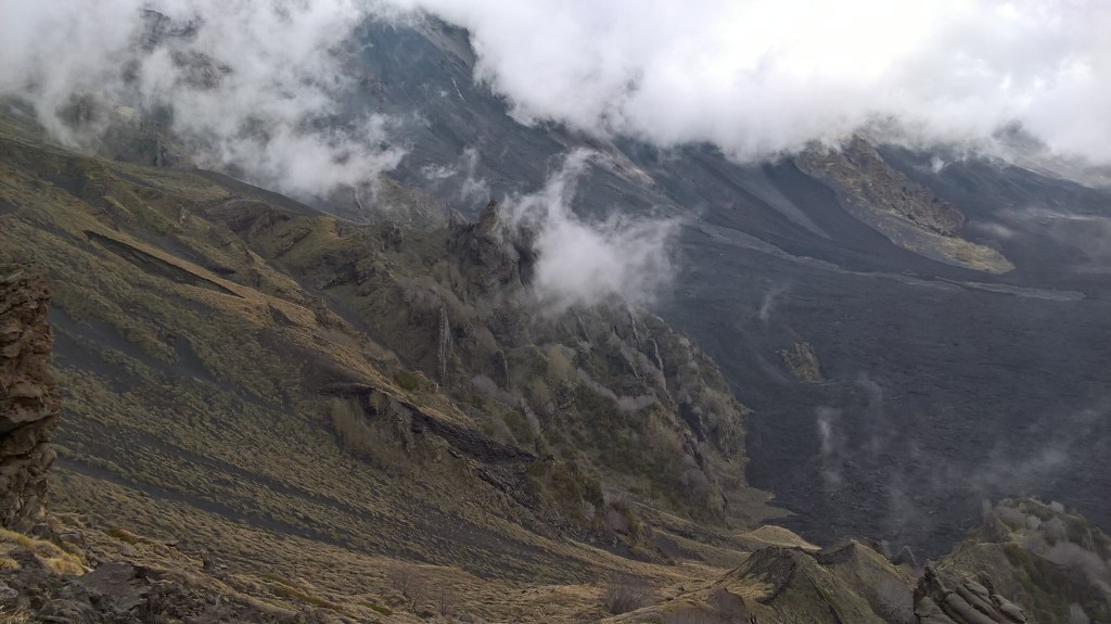
Lyell devoted multiple chapters to discussing Mount Etna in Sicily. These are some of the most engaging sections of the book, including field sketches, detailed observations, and poetic descriptions of the landscape. One of Lyell’s key observations was that the volcano sits on top of sedimentary rocks, which implies that this enormous mountain, one of the largest in Europe, formed very rapidly and very recently (in geological terms). He suggested that the volcano grew by ejecting lava and tephra, depositing layer after layer, and by producing dozens of volcanic cones.
Lyell then spent several paragraphs waxing lyrical about the Valle del Bove, an enormous depression on Mount Etna’s eastern flank. Still, you can hardly blame him – it’s worth waxing lyrical about. In his words, the Valle del Bove is “a vast amphitheatre four or five miles diameter, surrounded by nearly vertical precipices, varying from one thousand to three thousand feet in height.” Thankfully, UK distance metrics are still so antiquated that I can form a mental picture of these dimensions – although I’m pretty sure that three thousand feet is an exaggeration, at least for the vertical walls. Lyell also mentioned the “prodigious number of vertical dykes” as being “several thousands in number” – which is probably another exaggeration, if he is referring only to the Valle del Bove. I remember seeing dozens of dykes on my visit, maybe hundreds, but not thousands. Although it was very cloudy when I was there…

Lyell described the Valle del Bove as having been “deluged by repeated streams of lava,” leaving it “more uneven than the surface of the most tempestuous sea.” This is certainly the first time I’ve seen “tempestuous” in a scientific setting. Maybe we should bring these adjectives back, to spice things up a bit? I could do without the poetry quotations in every other paragraph though. In reading this Sicily chapter, I might as well have read all of Paradise Lost… Still, Lyell wins me back by stating that the dykes are “unquestionably the most interesting geological phenomenon in the Valle del Bove.” A man after my own heart, if I could only ignore the racism, sexism and questionable geological methods.
When it came to volcanic processes, rather than volcanic origins, Lyell was willing to offer up a few ideas. He stated that dykes were “the feeders of lateral cones”, and acknowledged them to be “channels which gave passage to the lava” (and for all you pub quiz pedants out there, it’s worth noting that the term “lava” was used to mean all molten rock, above or below ground, before “magma” was introduced to the English vernacular). When interpreting solid lavas, Lyell noted that some of the rubbly layers may have formed by angular fragments breaking up on top of a flow then rolling beneath it – which suggests to me that he either saw an active lava flow, or spoke to someone who had, because this is exactly what happens in these types of flows.
Volcanoes, from a modern perspective
Lyell’s volcano chapters are some of the most solid work in his book. Unlike his musings on climate or earthquakes, which are undermined by a lack of knowledge regarding plate tectonics, his discussions of volcanic processes have a similar structure to modern scientific writing. He presented observations, then made interpretations based on the evidence. He accepted that there was no way for him to infer the deeper processes governing the origins of volcanoes, but when it came to eruptive processes, he was on much firmer ground. His observations and interpretations of dykes, lavas and volcanic edifices are at a similar level to modern university fieldtrips (if a little exaggerated).
Still, even if Lyell had an intuitive understanding of eruptive processes, he could only make limited attempts to quantify them. It goes without saying that fluid dynamics and rock mechanics are impossible to simulate without powerful computers – and even then, these simulations are only useful if they can be applied to real-world observations such as ground deformation or seismic signals. None of these were available in 1830. Lyell was doing the best that he could at the time.
Now, think back to the questions I posed at the start of this post. How much has our understanding of volcanoes advanced since Charles Lyell went to Etna? With the discovery of plate tectonics, we can now explain the occurrence of volcanoes near plate boundaries, and theorise how changes in pressure or water content can prompt magma formation in the upper mantle. A vast array of satellite monitoring equipment and ground-based instrumentation means that we have a better understanding of ground deformation, gas emissions, and ash plume dynamics – and with all this data, we can run models that forecast potential dyke pathways, ash dispersal, or eruption likelihood. However, there are still some big questions from 1830 that have yet to be answered. Nobody knows exactly what a “magma chamber” looks like (or if they exist at all). We aren’t quite sure what triggers magma to start moving to the surface, or how it ends up in the crust. We don’t know why magma sometimes travels long distances laterally, instead of rising vertically. And we’re still searching for answers about hot spots.
When it comes to volcanoes, advances in understanding have been driven by advances in technology. However, we are still hindered by that eternal geological obstacle: solid ground. We can track changes on the ground itself, and in the air above it, but when it comes to exploring subterranean processes, our options are limited. Our best method is to infer magma movements from earthquakes – but we have no way of directly observing the processes that trigger seismicity. As such, we are limited to best guesses, based on intuition or analogy. Lyell would not have approved. But until we find a way to image the roots of volcanoes in real time, this is the best we can do.
In summary…
That brings us to the end of this three-part series! Hopefully you have enjoyed this foray into science history. We discussed the generation of knowledge, the nature of truth, and the inherent biases that will always be present in scientific research (while humans are involved, anyway). This final instalment on rocks, earthquakes and volcanoes showed the importance of technology in allowing us to collect and analyse ever larger datasets, and highlighted the barriers still to be overcome (namely, in finding new and better ways of detecting what is happening beneath our feet). How much more data will we have 200 years from now? And will it have changed our fundamental understanding, or merely added more detail to our existing model?
Happy reading, and have a lovely week!
Discover more from C. W. Clayton
Subscribe to get the latest posts sent to your email.
